
Best Trekking Spots in Kyrgyzstan: Self-Guided Treks, Peaks, Remote Treks etc
Self-Guided Treks in Kyrgyzstan
Are you an independent traveler? Do you like the freedom of trekking at your own pace and to stop and take pictures or stop when you wish? I have created a list of great trekking spots here in Kyrgyzstan where you can hike independently. If you wish to hire a guide or to join an open group tour with a guide that knows the areas from first-hand account feel free to write me. I can set you up with local guides and drivers to show you the best spots here in Kyrgyzstan. If you would like to rent a 4x4 for your trip where you can do the hikes from the doors of your 4x4 let me know I can rent you a strong 4x4. I hope you like the list that I have created and tell your friends about Kyrgyzstan!

Alex Nomad's Land
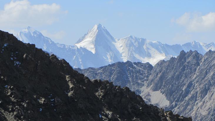
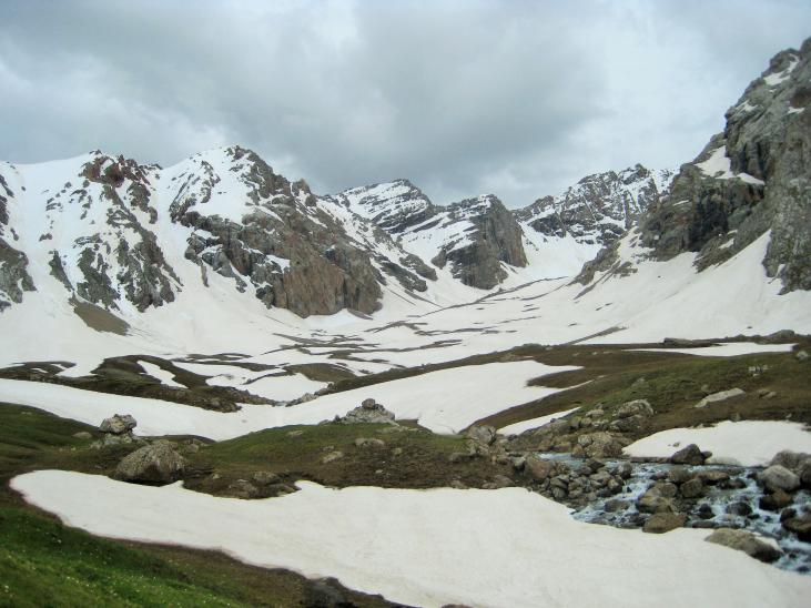
Ala Kul Hike
Ala Kul is a beautiful, glacier-fed lake high in the mountains above Karakol. It is a challenging hike, with lots of climbing, but well worth the trouble of getting there. You must cross several boulder fields on the way up to the lake, so wear sturdy boots. And the lake is at an elevation of about 3,900 meters, so it can snow at any time of year. The hike can be done in as little as three very long, challenging days, but four days is the standard time for this hike. At Altyn Arashan there are hot springs and several guesthouses where you can soak in them. It's a great way to spend the last evening on the trail. It's recommend to spend the night at VIP Travel Guesthouse before the bridge.
Distance: 54.23 kilometers
Start: 42º22.955'47.3”N, 78º27.648'37.5”E; elevation: 3,753.6 meters
End: 42º29.79'10.5”N,78º31.424'9.44” E; elevation 3,562 meters
Pass: 42º19.587'23.6”N, 78º32.706'26.9” E; elevation 4,212.6 meters
Total elevation gain (one way): 4,352 meters
Total elevation loss (one way): 4,706 meters
Difficulty: 4 (long and steep all the way up to the pass, with several boulder fields to cross).
You can get a taxi from Karakol to the starting point of this trek—the wood automobile bridge over the Karakol River. From there, it's about 15 km. to the wooden footbridge over the river that leads to the trail to Ala Kul. There is a campsite near the footbridge where most hikers spend the first night. From the footbridge, the trail goes almost straight up what looks like a dry stream bed. After a couple of steep climbs, you reach a boulder field. If you stay to the left (north), you will strike the trail again on the other side of the boulder field. Soon after you will come to a small hut and campsite that is about halfway from the footbridge to the lake. Continue up along the river, climbing and climbing until you reach the lake. There are campsites both above the lake near the trail and below next to the lake. From the lake, the trail climbs along the lake to the pass. You will have views of the Takur Tor Glacier at the east end of the lake as you climb. The pass is at about 3,900 meters. The initial climb down from the pass is steep, but then flattens out. Once you reach the Arashan River, stay on the left (west) bank until you reach Altyn Arashan, where there is a footbridge across the river and several guesthouses, some of which have camping spots. From Altyn Arashan, the path drops pretty consistently and flattens out as it reaches the village of Asku / Teploklyuchenka, where you can catch a taxi or marshrutka # 350 back to Karakol.
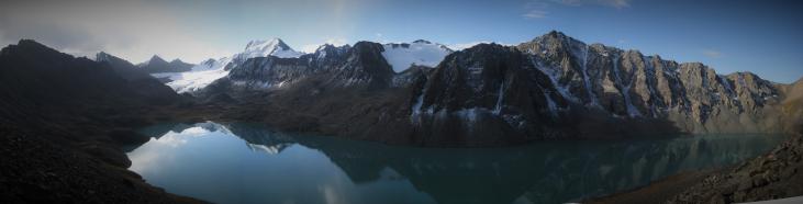
Tash Rabat to Chatyr Kul Hike
This is a great hike from Tash Rabat to Chatyr Kol. It's long, so if you are taking camping equipment, you would probably want to do this in two days. There is a yurt camp at the end of the hike near the Chatyr Kul lake, so you can do this with a day pack (the yurt is only open from ~July 1stto the 30thof August. There are yak herds along the trek, so you are likely to encounter them. They tend to be afraid of humans.
Distance (one way): 21.6 kilometers
Start: 40º51'47.3”N, 75º16'37.5”E; elevation: 2,978 meters
End: 40º43'10.5”N,75º17'9.44” E; elevation: 3,616 meters
Pass: 40º44'23.6”N, 75º17'26.9” E; elevation 3,996 meters
Total elevation gain (one way): 1,338 meters
Total elevation loss (one way): 703 meters
Difficulty: 4 (long, but not too steep, except at the pass.
From Tash Rabat, follow the river up the valley. About half-way up the valley (at about 40º46'37.9”N, 75º18'20.7” E), the river splits—follow the right (westerly) fork. When you come to the end of the valley, you can continue straight up, which is a tough climb; left (where the path is); or right (westerly). Any of these ways will take you to the lake, but you may have a hike to get to a yurt camp. The right (westerly) pass leads straight to a yurt camp. If you're camping, the left path is slightly easier. Note that if you take the right path, you won't be able to see the lake from the pass: the climb down bends to the left, at which point the lake will be visible (if there are no clouds).
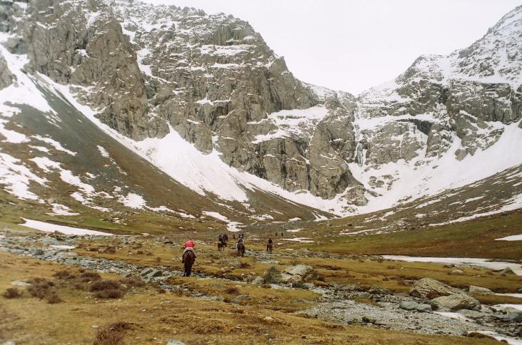
Shaar Waterfall
The Shaar Waterfall is the highest in Central Asia. It's a three to four-hour trek, one way, by horse or on foot. The trek is a pleasant one, but it includes quite a bit of climbing, some of it steep, and several shallow river crossings. There are some camping spots at the falls and more along the way, so it would be easy to do as a two-day trek if you have camping equipment. It’s possible to get camping equipment in Naryn City at a local tour company as well.
Distance: 29.5 kilometers (round trip)
Start: 41º09'40”N, 75º55'3.7”E; elevation: 2,207 meters
End: 41º03'51.9”N, 76º00'17.9”E; elevation 3,238 meters
Total elevation gain (one way): 1,345 meters
Total elevation loss (one way): 359 meters
Difficulty: 4 (long hike with some steep climbs)
The trek starts at the southerly edge of the village of Bash-Kaindy, about a fifteen-minute drive from the town of At-Bashy. You can arrange transportation with a taxi in Naryn City or in At-Bashy. To begin, just follow the clear stream up into the mountains. The trail climbs into the hills above the river after about 7 km. It doesn't drop down again until a few kilometers before the falls. At about kilometer 25, a large branch joins the stream from the west—do NOT follow it or you'll miss the falls. Once you reach the falls careful for falling stones or lose rocks.
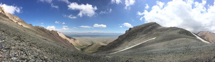
Salkyn Tor Hike
Salkyn Tor is a national park located about 12 km east of Naryn City. The entrance to the park is about 2 km. From the arch on the main road and there are toilets and picnic facilities near the entrance. A beautiful river runs the length of the park.
Distance (one way): 13 kilometers
Start: 41º26'34.5”N, 76º11'3.4”E; elevation: 2,167 meters
End: 41º22'17”N, 76º13'34.6”E; elevation: 3,221 meters
Total elevation gain (one way): 1,690 meters
Total elevation loss (one way): 660.5 meters
Difficulty: 4 (fairly challenging, but no technical climbing)
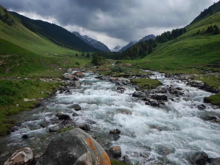
The hiking trail runs along the river and runs from the entrance area. You cross three pedestrian bridges in the first couple of kilometers of the hike. Once past the third bridge, the trail continues, crossing the river at several points. At a river crossing, watch carefully for the path on the other side, as it can be difficult to spot. There are many nice camping spots along the way, and the river is never far from the path. At about 10 km. there is a shepherd’s camp in a grove of pines on the east side of the river. It's concealed in the pines, so you may miss it. Above that camp, the trail disappears, and it's a rocky scramble up to tree line. At the tree line, the river splits, but both sides go up to glacier, which is the source of the river. There is a beautiful open valley at the top. Snow bridges covered the river at several spots in late June, and there is lots of snow at the top.

Ala Mischuk Hike
Bag a peak, right in Naryn! This hike takes you to the top of the highest of the triple peaks that loom over Naryn. It will take you 8-12 hours, but the views are spectacular. It’s important to check the weather before you go because you will be very exposed to the weather.
Distance (one way): 7.31 kilometers
Start: 41º25'33.3”N, 75º57'2.3”E; elevation: 2,030 meters
End: 41º23'45.4”N, 75º56'7.7”E; elevation: 3,323 meters
Total elevation gain (one way): 1,596 meters
Total elevation loss (one way): 308.5 meters
Difficulty: 4.5 (long and steep for most of the hike)
This hike starts just behind the large park across from the westerly automobile bridge that crosses the Naryn River. Go through the park to the canal behind the park, then look for the small, concrete bridge that crosses the canal. Across that bridge, you'll see some houses up on a ledge. Climb up to the houses and along the street in front of them, which leads to a large valley. Follow the valley past the first green valley opening on the right as you climb. When you come to the second green valley (at 41º26'04”N, 76º06'17”E), follow it up through the trees. It's a long, steep climb. When you get up out of that valley, you'll see the peak above you up a long, steep, grassy slope. Climb up an enjoy the views from the top of the Naryn area!
Eki Naryn panorama
This hike starts at Akel's Yurt Camp, just over the second automobile bridge after (north) of the village of Eki Naryn. There are many jeep and trekking paths in the area, and they all lead to beautiful pastures.
Distance (one way): 3.45 kilometers
Start: 41º35'11.66”N, 76º26'37.8”E; elevation: 2,356.4 meters
Top: 41º34'42.78”N, 76º25'39”E; elevation: 2,740 meters
Total elevation gain (one way): 116.13 meters
Total elevation loss (one way): 27.37 meters
Difficulty: 2 (easy hike, some modest climbing)
From Akel's Yurt Camp, start out on the jeep path into the mountains. You can continue to follow the jeep path, or head up one of the steeper but faster footpaths. Just above the tree line you will reach a broad plateau. From there, there are many paths into the jailoos (pastures) and surrounding mountains. It’s a great spot to spend the night or a great spot to get off the beaten path and meet real Kyrgyzstan.
Birinchi Mai Hike
This easy day hike goes directly into the mountains from the village of Birinchi Mai (May Day). It's a beautiful hike that passes many yurt camps, where local families stay for the summer while their animals are in the high pastures. If you're lucky, you may be invited into one of their yurts for a cup of tea or a glass of kumiss (horse milk). The route starts a few kilometers outside of Birinchi Mai, but it’s certainly possible to hike directly from the village. The path continues much farther into the mountains too, so this could be made into a multi-day trek.
Distance (one way): 2.46 kilometers
Start: 41º8'22.1”N, 76º2'47.6”E; elevation: 2,499 meters
End: 41º7'8.8”N, 76º2'42.7”E; elevation 2,707.5 meters
Total elevation gain (one way): 208.5 meters
Total elevation loss (one way): .27 meters
Difficulty: 2 (easy hike, some modest climbing)
The trail follows the beautiful river that flows through Birinchi Mai. You can either hike directly from the village, or take a taxi to the described starting point, and skip some less-interesting scenery. The trail climbs steadily, but is not too steep. There are many beautiful picnic spots along the trail, and you're never far from the river. It’s possible to make this into a two-day hike where you sleep in the tent and reach a nearby peak the next day. The view from the mountain pasture is great and it’s possible to meet locals living in Yurts in this untouched area.